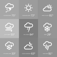
- Timing -- A few light rain or mountain snow showers today into tonight. Gusty south winds areawide Wednesday. More widespread light rain with mountain snow accumulations Wednesday late afternoon into early Thursday morning - tapering to showers Thursday along with continued gusty westerly winds. Could see some light snow for our friends in VC Wednesday night. Generally quiet Friday-Saturday with possibly another storm sometime in the Easter Sunday through next Tuesday timeframe.
- Impacts -- No flooding issues expected. Travel slow downs due to snow over the mountain passes Wednesday after sundown into the Thursday morning commute for mountain communities. Worst snow issues likely to be Alpine Co up into Tahoe and NE California. Winds resulting in enhanced turbulence/wind shear and tricky travel in wind prone roads on Wednesday into Thursday - nothing too out of the ordinary. Too soon to tell nature of impacts for potential storm early next week.
- Context -- The systems this week are typical spring deals. The one for early next week has the potential for being moderate-strong but again the predictability is low so it's too soon to label this one.
- Confidence -- High that we'll see a storm in the region Wednesday-Thursday with some snow travel impacts at night. Our +/- 500 foot snowfall scenarios don't yield much difference from the favored forecast attached. Low confidence on storm potential for next week but overall pattern does favor additional storms with low chances of prolonged dry and warm weather.
- Advice -- Plan for extra travel time in the mountains Wednesday evening into the Thursday morning commute. This time of year snow that falls at night has a much better chance of sticking.
CONTACT US:Sierra Booster Newspaper
PO Box 8 Loyalton, CA 96118 Phone: 530-993-4379 Fax: 844-272-8583 Email: [email protected] Website Privacy Policy |
©Copyright Sierra Booster - Sierra County News - Editorial
Website by Chamber Nation
|
