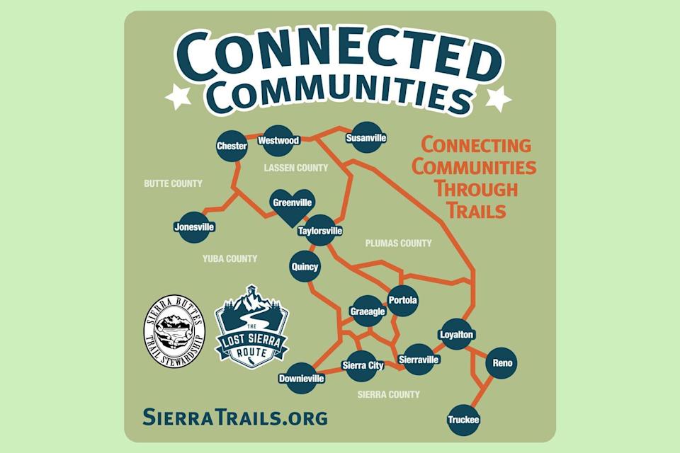
Graphic with loosely accurate map of the Lost Sierra Route, connecting mountain communities
Courtesy of SBTS
Ken Etzel
Think you've climbed every mountain? Searched high and low? Followed every byway and every path you know? Well, The Connected Communities Project is hoping to remedy that problem by bringing the hiking community a new 600-mile path to enjoy.
The Connected Communities Project, a partnership between the Sierra Buttes Trail Stewardship (SBTS), the U.S. Forest Service, and other community partners, is on a mission to create a 600-mile network of multiuse trails that will one day connect 15 northern California mountain towns to Reno, Nevada. And it will be known as the Lost Sierra Route.
"It will create a vision for a recreation-focused lifestyle through community investment, shared stewardship, economic opportunity, and important new local jobs, all benefiting economically disadvantaged communities in California's Plumas, Sierra, Butte, and Lassen Counties," SBTS explains on its website about the project. "Our work will include planning, environmental review, trail creation, and maintenance of trails. It is the intent of this project to diversify recreation throughout the region, provide economic stability, as well as support fire recovery and prevention efforts."
Additionally, SBTS noted, the trail will create a learning landscape and pay homage to the region and the historic Gold Rush-era mail delivery route as it makes its way over "jagged peaks and high alpine meadows similar to the Pacific Crest Trail and the John Muir Trail."
But unlike those trails, this one will allow for all "dirt trail travelers," which not only includes hikers, but also mountain bikers, motorcycle riders, equestrians, trail runners, hunters, and fishermen to create what it calls "A Trail for Everyone."
Along the way, the trail will highlight 15 mountain communities to help support local economies that have been devastated by everything from the loss of the mining industry to more recent events like wildfires and COVID-19.
"Each mountain town has something unique to offer in terms of terrain, nature, adventure, food, camping — and all have a rich history to experience," SBTS shared. "Through our Planning Phase, we've captured input from community locals on what they'd like to highlight about their town, where they want trails to be located, and the outdoor experience the neighborhood topography and landscape has to offer."
The first section of the trail is expected to open in 2023, while the entire route is slated to debut by 2030. Want to help the project finish a little sooner? See all the ways you can get involved, and keep track of the progress on the SBTS website.

